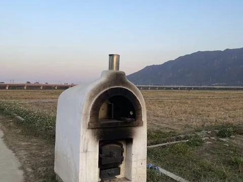
Geo-Sleuth Photo Research — An oven at the edge of a rice paddy, a viaduct and a mountain behind
プロジェクトのスクリーンショットこのスキルについて
Investigate where a photograph was taken using metadata, OCR, terrain and skyline comparison, and an explicit evidence trail.
おすすめする理由
Curated from the upstream task instructions. Use the original repository and its linked runtime files for installation, dependencies, and licensing.
使う前に
- Requires the upstream Python tools and configured research or vision services; location estimates should retain uncertainty and evidence.
対応エージェント
Claude CodeCodex CLICursorGitHub CopilotDeepSeek HarnessGemini CLIGrok BuildHermes AgentOpenCodePiKiroRovo DevQoderMistral VibeGoogle Antigravity
資料・参照元
元の資料は以下のリンクから確認できます。実践のヒントは SkillHey による編集上の提案です。