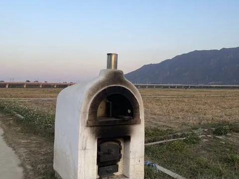
Geo-Sleuth Photo Research — An oven at the edge of a rice paddy, a viaduct and a mountain behind
Capturas do projetoSobre este Skill
Investigate where a photograph was taken using metadata, OCR, terrain and skyline comparison, and an explicit evidence trail.
Por que escolhemos
Curated from the upstream task instructions. Use the original repository and its linked runtime files for installation, dependencies, and licensing.
Antes de usar
- Requires the upstream Python tools and configured research or vision services; location estimates should retain uncertainty and evidence.
Agentes compatíveis
Claude CodeCodex CLICursorGitHub CopilotDeepSeek HarnessGemini CLIGrok BuildHermes AgentOpenCodePiKiroRovo DevQoderMistral VibeGoogle Antigravity
Fontes e referências
As fontes originais estão nos links abaixo. As sugestões práticas são recomendações editoriais do SkillHey.